Long Trail 2023
From September 8th to October 4th 2023, I thru-hiked Vermont’s Long Trail. You can read about my journey here—these pages contain my trail journal along with some background to set the scene.
About the trail
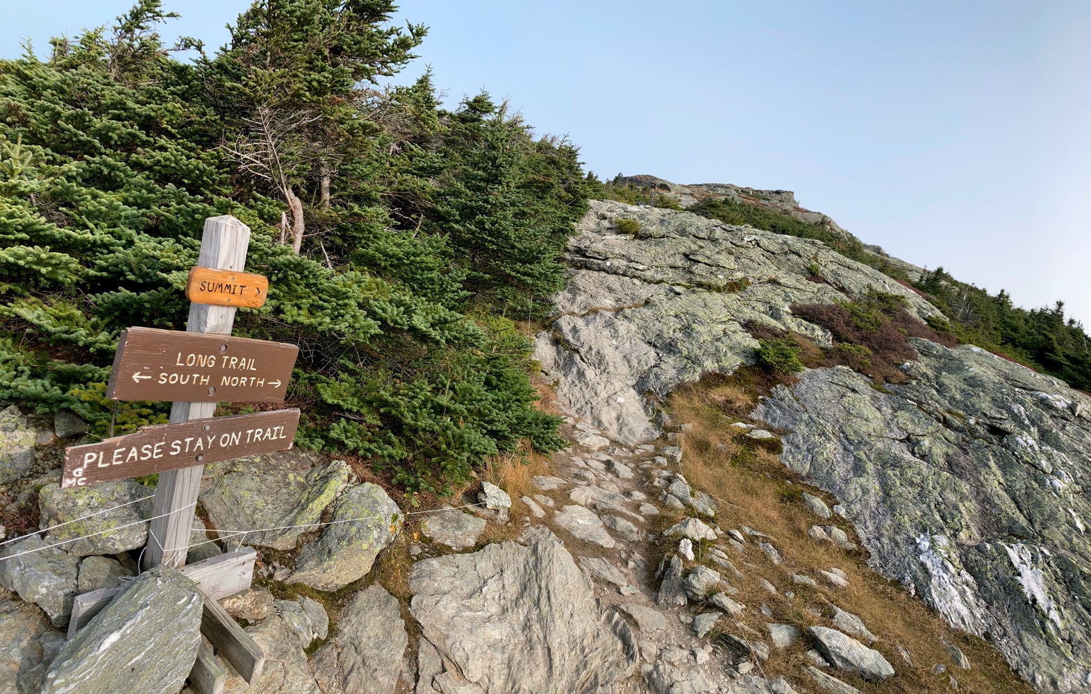
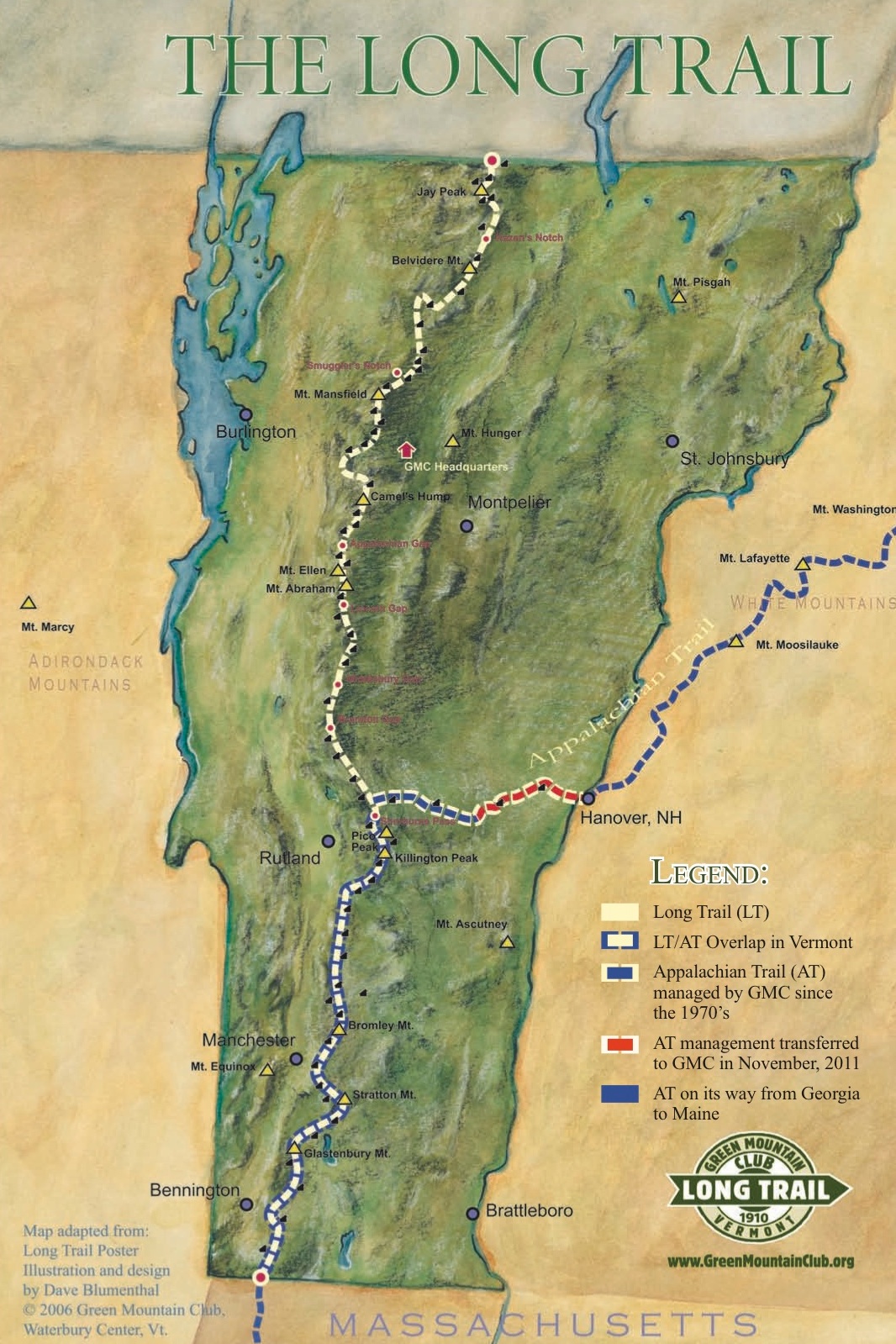
The Long Trail was the first long distance hiking trail in America, and the inspiration for the Appalachian Trail, with which it shares its first 100 miles. It runs 272 miles along the spine of the Green Mountains, from the Vermont-Massachusetts border to the Vermont-Canada border. It has a reputation as a difficult thru-hike due to its steep and frequent climbs (especially in the northern section), as well as lots of rain and mud1. The trail is maintained by the Green Mountain Club; you can read more about it on their website.
About me
Like many who attempt a thru-hike, I’d found myself at a crossroads in life. A few months before, I’d gone through a breakup, left my job of seven years at the Recurse Center, and moved out of New York City, my home for most of my adult life. I had my reasons for all these changes, but none of them were easy. It was a huge amount of turbulence all at once, and both working at RC and being a New Yorker were huge parts of my identity. The time felt right for something restorative and reflective like hiking.
I’ve harbored a desire to do some kind of thru-hike since I was young, having been aware of the Appalachian Trail and compelled by the quixotic romance of being an “end-to-ender” as long as I can remember. I did a lot of backpacking and wilderness canoeing as a teenager and have always thought of myself as an outdoors-y person, but that fell by the wayside in my 20s. I had a vague desire to reconnect with that part of myself, but never managed to act on it. Now I had the time and the motivation. By the time I’d finished moving out of New York in June of 2023, it was too late to start one of the triple crown trails, but the LT seemed perfect. It would only take about a month to hike, I’d have several months to plan, and I’ve always had an affinity for New England forests, having spent a lot of time in Maine growing up.
The first two questions every potential thru-hiker faces are “When?” and “Which direction?”. I decided to go NOBO2 in September. NOBO is the traditional direction to hike the LT, and would let me build up my strength in the relatively flat south before hitting the big climbs in the north. September is generally considered a good time to hike—the worst of the summer heat is over, and the bugs are mostly gone. I was also looking for a balance of solitude and socializing, and I hoped that going in the fall rather than the summer would mean a less crowded trail. I’d also be able to see the peak fall color in the north in early October.
Between a few trips to REI and my old gear from my teenage years, I cobbled together everything I would need. My gear was functional, but heavy. My pack and sleeping bag were from the 2000s and far from ultralight—just the two of them weighed about nine pounds. I didn’t have a scale, so I didn’t weigh my pack before starting, but I suspect it was over 40 pounds fully loaded. For the curious, there’s a more detailed discussion of my gear choices and what I would do differently with hindsight in the epilogue.
After an overnight shakedown trip with my good friend Rachel, just to make sure I still remembered how to backpack, I was ready. I bought a train ticket to Pittsfield, Massachusetts, near the southern terminus, and booked an overnight stay in town, planning to set out hiking on the morning of Friday, September 8th.
About this journal
This journal is partially transcribed from the handwritten journal I wrote during the hike, and partially written later from my memory.
I’ve tried to keep the focus on what I felt and experienced, rather than getting bogged down in technical details about gear and day-to-day backpacking minutia. The main text assumes some knowledge of backpacking and thru-hiking, but I’ve tried to explain anything potentially confusing in the footnotes.
I’ve also tried to be as honest as possible—if I remember feeling a certain way, I mention it, even if it’s a little embarrassing, sounds corny in hindsight, or doesn’t really fit into the story neatly. It’s how I actually felt while I was out there, and that’s what I want to convey.
My journey
- To the trailhead
- Southern Terminus
- Glastenbury Wilderness
- Glastenbury Mountain
- Stratton Mountain
- Manchester Center
- Bromley Mountain
- Peru Peak Wilderness, Griffith Lake, and Big Branch Wilderness
- Clarendon Gorge
- Killington
- The Inn at the Long Trail
- Rutland
- Maine Junction
- Battell Wilderness
- Ripton
- Breadloaf Wilderness
- Mt. Abraham and Mt. Ellen
- Burnt Rock Mountain and Mt. Ethan Allan
- Camel's Hump
- Waterbury, Ben & Jerry's
- Bolton Mountain
- Mt. Mansfield
- Morse Mountain & Beaver Meadow
- Whiteface Mountain & Jeffersonville
- Codding Hollow & Laraway Mountain
- Devil's Gulch, Mt. Belvidere, Hazen's Notch
- Jay Peak
- Canada Border
- Journey's End
- Epilogue
-
The rain and mud were particularly challenging this year, as Vermont experienced unprecendeted flooding. Thru-hikers who started in July were rained on every single day of their trip, with only a few patchwork hours of clear skies. Thankfully, I started in early September and had much better luck with the weather. The impact of the floods was still clearly visible all around me though. ↩︎
-
Like any subculture, long-distance backpackers have their fair share of jargon. “NOBO” and “SOBO” are hiker slang for “northbound” and “southbound” respectively. Most long-distance trails run generally north or south. “Are you NOBO or SOBO?” is a common first question to ask when meeting another hiker on the trail. ↩︎